Wednesday, October 29, 2008

Coffin Races - Manitou Springs, CO


This entry is not really in line with the rest of the blog, but I thought it was a fun event that definitely qualified as a "race" on some level. Manitou Springs is a weird town, and it's only fitting that it hosts one of the weirdest races that I have ever done: The Emma Crawford Coffin Races.

Emma was a resident of the town who moved to Manitou for her tuberculosis. Unfortunately she passed away, and buried in a grave on top of Red Mountain. During a heavy rainstorm her coffin was washed back into town. And now we celebrate that journey, and her life, with the coffin races.

This is the basic setup of the event: a bunch of people get in crazy costumes, bring their custom coffins to town, strap some numbers on, place their "Emma" in the coffin and then race 2 at a time down Manitou Avenue for 250 yards. Oh, and there is a hearse parade and prizes for the best "Emma." Our coffin did not do as well as we wanted (30 something out of 40+), but we had a great time, and managed not to take anybody out in the crowd, which was a moral victory.

Thanks to Kristian for the picture.

Wednesday, October 15, 2008

Waldo Canyon - Manitou Springs, CO

I recently made my second trip to Waldo Canyon 22 years after my first visit. I think a deep childhood trauma has prevented me from exploring it.

When I was 4, my dad decided to take me to his friends' wedding, which was in a meadow about 2 miles up the trail. Before the wedding attendees started out on the hike, they were handed balloons filled with helium that we were supposed to release when the ceremony was over (I know - big no no, but it was the 80's). We pulled into the parking lot, got our balloons, and started heading up the trail. On our first try we made it about a 1/2 mile into the hike before my stumpy legs and resulting short stature resulted in my balloon brushing up against a yucca plant and popping. My dad, good sport that he is, gave me his balloon and we kept going, until my height problem again resulted in a popped balloon. Seeking to avoid me throwing a fit, my dad turned us around, back to the parking lot where we resupplied ourselves. I believe we visited the parking lot two more times that day, in a Sisyphean effort to make it to the wedding with undamaged balloons in hand. By the end, my dad was carrying me, two balloons, water and a scowl. To this day whenever I mention Waldo Canyon my dad shakes his head, growls and mutters to himself; "Stupid hike took forever. Why did I have kids. I hate balloons. Where is my scotch." Since that day I have been hesitant to return to the spot that has caused so much grumbling over the years.

Surprisingly, Waldo Canyon does NOT take forever, and makes for a much better run than hike. The overall setup of the trail resembles a big lollipop. The first section is about 2 miles long, winding up the hillsides before winding back into the Canyon and running through a wide meadow (the wedding site!). This first section is pretty gradual, winding mostly uphill until the last 1/2 mile. About 100 yards past the meadow, the trail splits, forming a 3.5 mile loop (there is an obvious sign). To the left the trail winds up a narrow canyon, following a creek. To the right, the trail climbs steeply up a number of switchbacks, cresting numerous times onto ridges before dropping into the canyon with the creek. I have only gone counterclockwise, which starts with a series of steep switchbacks before leveling out as the trail runs along two ridges and then eventually starts winding downhill into the canyon. It looks like either way is equally difficult as both require steep climbs right at the beginning. Regardless, the views within the loop are amazing; canyon walls, Pikes Peak, Manitou. Great from any direction.

The trails is fairly heavily populated, but it seems like most people stop at the meadow and avoid the loop. The trail is dog friendly too. Waldo is my new favorite run in this part of Colorado, one that definitely makes it easy to come back for more.

Directions: From downtown Manitou, head West on Highway 24 for about 2 miles. The parking lot and trailhead is on the right. Watch for a sign on the right hand side of the Highway that indicates a trail is ahead.

The Vanilla Gorilla

Yesterday the New York Times had an interesting article about Dave Wiens, the mountain biker who has won the Leadville 100 the last 6 years in a row (article here). From the tone of the article, I felt like the author was a bit blown away that Wiens beat Armstrong (and Floyd Landis the year before) without any hardcore training. I enjoyed it because it showcased Wiens as a great athlete that has found a great balance between family, work and staying fit. A balance I hope to be able to reach once I kick this whole not having solid employment thing. My favorite part of the article is the part where it talks about how because Wiens never shaved his legs when he was racing the other riders called him the "Vanilla Gorilla." For some reason I identify with the Gorilla part.

Friday, October 10, 2008

Incline to Barr Camp - Manitou Springs, CO


Due to my extended stay in Manitou I have been able to do a more extensive reconnaissance of the trails in the area. For the most part I have known about, or heard about, most of the trails around town, but with the advent of more time on my hands (translation: jobless) I have been able to explore more of the area. The Incline to Barr Camp run was the result of three things: 1) a desire to revisit Barr Camp after about a decade 2) an attempt to experience the Colorado fall and 3) a need to do some high altitude running to prepare for the Golden Leaf. I had the last reason on my mind the most when I started exploring the run, but that quickly gave way to enjoying the incredible scenery provided by the mountains and the aspen groves running through them. For some reason, when the run is gorgeous, like Eagle Creek or this one, it makes running for long periods of time so much easier. For this reason, I think I would be obese if I had to move to the Midwest.

I started the run by doing the Incline first. I wanted to do this to bypass the series of steep switchbacks that typify the beginning of Barr Trail and to get to 8600 feet or so as quickly as possible. From the top of the Incline, there is an access trail to the upper portion of Barr Trail. You can find it by walking straight, as if the Incline continued, until you reach a trail that angles up (there are some logs stacked next to the beginning of it). Do not confuse this trail with the one that angles slightly down, in the same general area. The downward trail dead ends into some impassable fencing. Once you are on the access trail, it is about a 1/2 mile to the intersection with Barr Trail.

From the intersection with the trail, the run heads up Barr Trail toward Barr Camp, gaining about 2,000 feet in elevation over 4 miles. The climbing is mostly gradual, winding through meadows and forest area until it reaches Barr Camp, located at 10, 200 feet. There are numerous vista points along the run that are home to some incredible views. Pikes Peak is almost always in front of you as you run, and the before mentioned aspens pocket the area. There are points where you actually run through aspen meadows, with the leaves forming a carpet on the trail. Pretty awesome.

From Barr Camp I simply turned around and headed back down the trail, all the way to the bottom (no desire to explode my knees trying to do the Incline in reverse). The whole thing took me 2 to 2.5 hours. I would bring some food and water, as there are not any freshwater sources that are drinkable on the run. Barr Camp, when it is open, sells food if you want to bring cash instead.

Overall I would say that this is one of my favorite runs in the area. It is a bit long, so perhaps best to do it during the weekend. The trail was not too crowded, but that changes during the weekends. The temperature at Barr Camp is usually about 10 to 15 degrees cooler than the town temp, so dress accordingly. Something else to thing about: Mountain lion attacks. I have an irrational fear of being mauled by a mountain lion whenever I run in this town. Although wouldn't it be awesome if a mountain lion tried to maul you and you killed it and then used its teeth to make a necklace that you wore to the bars to impress the ladies? That would be the ultimate.

Wednesday, October 8, 2008

Golden Leaf Half Marathon - Aspen, CO


A race should be a celebration of sorts for the place in which it is held. A showcase of the location for the riders or runners who often travel long distances just for that event. Most races are based around the city or place where it is held - The Seattle Marathon, the Tour de France, the Bolder Boulder and so on. Ideally, the race route rises to the occasion, providing a challenging race while at the same time giving its participants a reason to come back year after year.

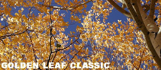
This is of course my ideal race, and thanks to the persuasive abilities of Max, I headed up to Aspen for the Golden Leaf Half Marathon to race in, what is now, by far, the best race setting I have experienced (although the Seattle Marathon and the Shamrock Run are both fantastic as well). The race starts at the base of Snowmass Mountain with a 1.5 mile climb up access roads to the beginning of Goverment Trail. This is a serious climb, gaining almost 800 feet before the trail cutoff. It fractured the entire pack of runners almost immediately. Thankfully, after the first section, the race turns down onto the singletrack and heads slightly downhill for most of the race. The trail is narrow, strewn with rocks and branches and passing people was difficult. However, the race runs through meadow after meadow full of Aspens that have already turned for the Fall. With my eyes constantly on the ground in front of me to prevent myself from tripping, I couldn't help looking up toward the trees and trying to take the whole scene it.

After the race winds through both Snowmass and Buttermilk it dumps you into the Maroon Creek area, where it picks up the bike path, and a dirt path through a meadow, before eventually winding into the streets of Aspen, where it finishes at Koch Park, at the base of Aspen Mountain. The finish area added icing to the cake. Great food, lots of water, and a raffle that gives a way a ton (as in, so much that Max said that almost everyone gets something. Except for me). And all of this for only a $35.00 registration fee. It was incredible, and made me want to move up to Aspen even more. The whole vibe was very inclusive and community oriented. Definitely my new favorite race.


Friday, October 3, 2008

Government Trail - Aspen, CO


I explored Government Trail on another one of those days where I decided it would be a good idea to ask Max for a good trail run to check out. He guided me toward the base of Buttermilk Ski Resort and an access road leading up to the Government Trail, which runs from west to east along both the Snowmass and Buttermilk resort mountains. The trail actually starts in Snowmass Village, and is used in the summer for running and mountain biking (it is basically a single track trail) and in the winter for cross-country skiing. To access the trailhead, you have to take an access road from the village up to the trail. It is best to ask around town (try the Ute Mountaineer or the Hub) for exaclty where the trail starts, as I have not been able to find anything online that provides a good guide.

For our run, Max and I started at the base of Buttermilk Mountain and ran up an access road about a mile before we connected with the trail (actually we hiked a lot of it as "run" to Max is somehow equivicated to "easy mountain bike ride," as in "it should be a good run, it is an easy mountain bike ride"). We then followed the trail east until it dumped us out near the Aspen Rec Center, near the base of Aspen Highlands. From there we hopped on the bike trail for a bit before the trail begins running through a long grass field, which again dumped us out onto a paved trail which we followed all the way into Aspen.

Overall, the trail is a net downhill, but runs at about an elevation of 9500 feet before it winds down into Aspen. The trail runs through some incredible scenery, but is a bit rocky so watch your footing.

101 Cookbooks

I have been focusing on my diet a lot more lately, which has meant a lot more vegetables, a lot less sugars and more lean protein sources. This focus has been the result of dating a girl that loves to cook, but eats much healthier than I do and an awful morning or two after a hard night of drinking where my body rebels against the pizza I fed it the night before. Hence, a new approach to eating which has actually translated into feeling much better during long rides and runs. One of the websites we use frequently for recipe ideas is 101 Cookbooks, a vegetarian recipe website created by Heidi Swanson. She updates the site frequently with new recipes, and has everything broken down into categories. Everything so far has been delicious.